

Category:Coagh
English: Coagh is a small village in County Tyrone, Northern Ireland, situated five miles (8 km) east of Cookstown. Part of the village also extends into County Londonderry. It had a population of 545 people in the 2001 Census. It owes its existence to George Butle Conyngham of Springhill, and was founded in 1728 when King George II granted Conyngham a market charter allowing the village to host 4 fairs per year.
village in County Londonderry, Northern Ireland, UK  | |||||
| Upload media | |||||
| Instance of | |||||
|---|---|---|---|---|---|
| Location | Northern Ireland | ||||
| Population |
| ||||
 | |||||
 | |||||


Media in category "Coagh"
The following 49 files are in this category, out of 49 total.
-
 Aughavey Gospel Hall - geograph.org.uk - 271366.jpg 640 × 486; 46 KB
-
 B73, westbound - geograph.org.uk - 7031459.jpg 1,024 × 684; 96 KB
-
 Ballinderry Bridge Road, Coagh - geograph.org.uk - 1676344.jpg 640 × 480; 95 KB
-
 Ballygoney Fishing Club - geograph.org.uk - 271367.jpg 640 × 479; 58 KB
-
 Chambered grave at Tamlaght, Coagh - geograph.org.uk - 165936.jpg 640 × 290; 66 KB
-
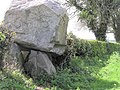 Chambered Grave near Coagh - geograph.org.uk - 166004.jpg 640 × 479; 131 KB
-
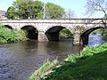 Coagh Bridge.jpg 640 × 479; 124 KB
-
 Coagh Orange Hall - geograph.org.uk - 290671.jpg 359 × 480; 44 KB
-
 Coagh RC Church - geograph.org.uk - 270861.jpg 640 × 479; 46 KB
-
 Facilities at Hagan Park, Coagh (Geograph-1676340-by-Dean-Molyneaux).jpg 3,648 × 2,736; 2.58 MB
-
 Hanover House, Coagh - geograph.org.uk - 115305.jpg 610 × 458; 143 KB
-
 Hanover House, Coagh - geograph.org.uk - 165941.jpg 640 × 478; 107 KB
-
 Lambegdrumming.jpg 990 × 403; 45 KB
-
 Littlebridge Rd - geograph.org.uk - 7031308.jpg 1,024 × 684; 109 KB
-
 Main St - geograph.org.uk - 7031454.jpg 1,024 × 684; 111 KB
-
 Main St, Coagh - geograph.org.uk - 7031316.jpg 1,024 × 684; 88 KB
-
 Tamlaght Townland - geograph.org.uk - 165934.jpg 640 × 479; 89 KB
-
 Tamlaght, Coagh - geograph.org.uk - 165938.jpg 640 × 479; 99 KB
-
 Tamlaght, Coagh.jpg 640 × 479; 93 KB


